Mongolia Topography: An overview
Map
First things first, below is an overview of Mongolia Topography.
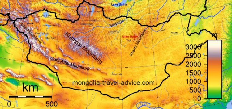
The above Mongolia topographic map can be viewed in more detail in a separate window by clicking here.
The main Mongolian topographic features are three mountain ranges, which create three separate river drainage basins and some different topographic zones.
Mountains:
The Khangai Mountain range runs east to west, through the centre of Mongolia. The Altai Mountain range runs north-west to south-east, along the western border of Mongolia. The Khentii mountain range runs north to south, to the east of Ulan Bator. You can read about the mountain ranges in more detail at my Page on mountains in Mongolia.
Rivers:
In the North and Centre of Mongolia, the Khangai Mountains and the west slopes of the Khentii Mountains point all rivers northwards to drain into the Selenge river (which fills Lake Baikal in Russia). This is called the Northern Atlantic basin.
The watershed to the east of the Khentii mountains drains into the Amur river in Chinese Manchuria. This is the Pacific Basin.
The rivers pushed east by the slopes of the Altai Mountains drain into an area called the Great Lakes Depression in west-central Mongolia, where they pool into large lakes and simply evaporate.
There is much more detail on my
Page on rivers in Mongolia.
Topographic zones:
It's important to understand the lay of the Mountains within Mongolia as they influence the rainfall and altitude in certain areas, and hence the topography of Mongolia.
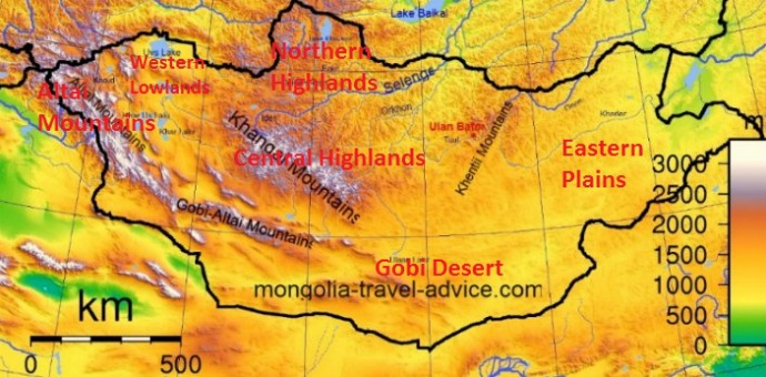
Mongolia topographic map: Mongolia topo map showing the different topographic zones listed below.
The Gobi desert lies in the south of Mongolia, and stretches into Northern China. The very low rainfall that created the desert is created by a rain shadow, formed by the 4,500 metre high Tibetan Plateau which blocks rain-bearing clouds some 2,000 miles to the South East. The Gobi desert is generally characterised by flat, dry plains, but the tail end of the Altai mountains does extend into the Gobi region, and its lower foothills are sometimes dubbed the Gobi-Altai range. You can read a lot more about the Gobi, including a detailed geography section, on my Page on the Gobi Desert.

Mongolia topography: the Gobi Desert. Most of the Gobi is formed by dry, flat plains.
The Central Highlands cover the Khangai Mountain range in Central Mongolia, and rise up North of the Gobi desert. The central highlands are characterised by the rolling, green steppe and big blue sky that generally form the popular image of mongolia topography. Still technically part of the Khangai Mountains, but with higher rainfall and snowfall as we move north towards Russian Siberia is the Northern Highlands, which are more heavily wooded with pine forest.
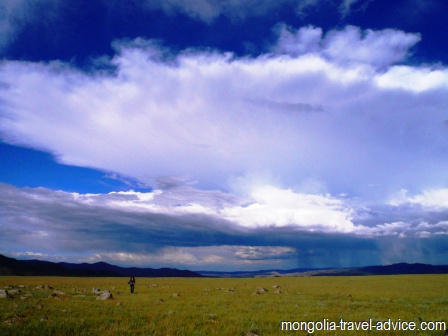
Mongolia topography: The gentle, open green steppe and rolling hills of Central Mongolia.
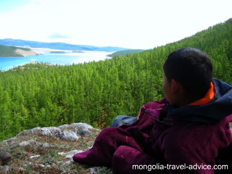
The more densely wooded regions of the Northern Highlands receive more rainfall.
The Eastern Plains are flat, open and grassy, with low-to-moderate rainfall. There isn't a great deal out here, except for the occassional small creek and herd of antelope, but the plains are a unique topographic feature in terms of being one of the world's great unfenced grasslands, and are UNESCO listed.
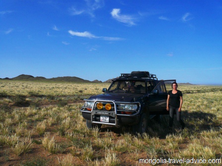
The Altai Mountains are higher, drier, rockier, and much more rugged than the Central Highlands. But due to the altitude they do get more snowfall in winter. Click on my page on the Altai Mountains page to learn more and see some pictures.
The rugged, rocky hills of the Altai Mountains
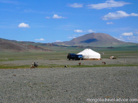
The Western Lowlands lie between the Altai Mountains and the Central Highlands. The surrounding mountains create a bit of a rain shadow over these dry lowlands, which are second only to the Gobi desert in terms of sparsity of population.
Some areas here are lower than sea level, which is unusual in Mongolia. This region is the driest in Mongolia. Rivers flow down from the surrounding mountains and pool into lakes here, but the region itself receives very little rainfall. It has the highest summer-time temperatures, and the lowest winter temperatures, in Mongolia: subject to some of the most extreme temparature variation in the world. The lowlands don't support a lot of life away from the lakes, either human or animal.
The dry, open spaces of the Western Lowlands. See my page on Zavkhan and Uvs provinces for more information
Back from my Mongolia Topography page to my Facts on Mongolia page
Back to homepage


